Saturday, June 30, 2012

The Heat Continues....

Sorry for the lack of update this morning as it has been another busy weekend.  Hope all have stayed indoors today.  This marks another day in the 100s and this one was one for the record books.

Records For Today:


  • Knoxville broke the record of 100 set back in 1952 with a high of 105 and this also broke the all-time record high of 104 set on July 12, 1930.
  • Chattanooga broke the record of 103 set in 1952 with a high of 107 and this also broke the all-time record high of 106 set on July 28, 1952 and June 29, 2012.
  • Tri-Cities broke the record of 95 set back in 1959 with a high of 103 and this also broke the all-time record high of 102 set on July 29, 1952 and June 29, 2012.


All the official recording stations in the area set all-time record highs today with the ridge firmly in place across the region.  This hot weather will be sticking around and the return of the moisture also.  The return of moisture also means the return of isolated thunderstorms mainly in the higher elevations.  Remember to take breaks and avoid the outdoors if possible.

Friday, June 29, 2012

Records Broken....

High pressure continues to dominate the region and this has made for some dangerous temperatures.  Multiple high temperature records were broken yesterday across East Tennessee.

Thursday's Record Highs:

Knoxville broke the record of 100 set in 1931, 1936, and 1956 with a high of 101
Tri-Cities broke the record of 96 set in 1952 with a high of 97
Crossville broke the record of 94 set in 1978 with a high of 97

Regional Highs for Thursday


I do expect today to be hotter with highs in the upper 90s to lower 100s.   These hot conditions have prompted a heat advisory for parts of the area today.  Another issue going into the weekend will be the return of higher dewpoints, and this will aid to produce high heat indices.  Remember these conditions are extremely dangerous and heat related deaths are the number one killer in meteorology.


Heat Tips: 


  • Take frequent breaks
  • Drink plenty of water
  • Limit time outdoors
  • Keep pets indoors


Also for those who have problems breathing there is a Air Quality Alert for today code ORANGE for all of East Tennessee.

airnow.gov AQI Forecast for today


Thursday, June 28, 2012

Surpassed Expected High....

Well the upper 90s have been surpassed at Knoxville with the temperature at 4PM reading 100 degrees.  This is some oppressive heat with areas across the state coming in at 100 or above to include Nashville, Memphis, Chattanooga, Paris, Clarksville, and Oak Ridge.

Regional Temperatures at 4 PM EDT

The Heat Is On....

Well the temperature will begin to really heat up today as high pressure dominates the area.  I expect highs today in the mid to upper 90s for most locations.  I do expect this trend to continue with highs expected to get in the lower 100s for Friday and Saturday.  I do not expect any precipitation even into early next week with temperatures staying in the upper 90s.  Everyone that has plans outside this weekend should make sure you take frequent breaks, limit exposure to the sun, and drink plenty of water.


Heat Tips: 


  • Take frequent breaks
  • Drink plenty of water
  • Limit time outdoors
  • Keep pets indoors


Also for those who have problems breathing there is a Air Quality Alert for today code ORANGE for most of East Tennessee.

airnow.gov AQI Forecast for today


Wednesday, June 27, 2012

Heat Begins To Build In....

The heat will begin to build into the area today as high pressure dominates the surface. I expect clear skies and temperatures in the upper 80s to lower 90s.  The temperatures increase as we move into the weekend with parts of the region making it into the 100s.  This trend of 90s and 100s does not look to end anytime soon with long range models indicating zonal flow (meaning no troughs which help to produce precipitation and changes in temperature).  If you are going to be outside remember to drink plenty of water and limit time outside.

HPC Surface Analysis at 5:00 AM EDT


Heat Tips: 


  • Take frequent breaks
  • Drink plenty of water
  • Limit time outdoors
  • Keep pets indoors


Also for those who have problems breathing there is a Air Quality Alert for today code ORANGE for most of East Tennessee.

airnow.gov AQI Forecast for today 

Tuesday, June 26, 2012

Starting Over....

Today with temperatures in the lower to upper 80s for Knoxville and Tri-Cities they start there 90 or above count with Knoxville ending at 7 and Tri-Cities ending at 3.  The Chattanooga Site will make it to 7 today and I expect them to be 90 or above for a minimum of 5 more consecutive days.


Current Record Highs:


Thursday  Friday  Saturday  Sunday 
Knoxville  100/1952  101/1936  100/1952  100/1954 
Chattanooga  104/1952  102/1936  103/1952  101/1954 
Tri-Cities  96/1952  95/1952  95/1959  98/1959 

Warm....

Today will be warm with temperatures in the mid to upper 80s, but with dewpoints in the lower 50s to upper 40s it will feel much better.  This airmass will not stick around long as hot and moist conditions will continue to set in as the week goes on.  The model output statistics indicating 90s and even 100s through early next week.  Models have also indicated slight chances of showers and thunderstorms over the weekend.  I think most of these will be afternoon variety and mainly confined to the higher terrain.  If you are going to be outside Thursday through Saturday temperatures will be in the upper 90s to lower 100s.  These kind of temperatures are dangerous and you need to limit your time outdoors.


Heat Tips: 


  • Take frequent breaks
  • Drink plenty of water
  • Stay out of the sun as much as possible
  • Keep pets indoors


Monday, June 25, 2012

Brief Relief....

Good to be back and it does not look like much has changed forecast wise.  Expect another hot one today with temperatures across the area in the lower to mid 90s.  This will be Knoxville's 8th consecutive day at or above 90 degrees.  There is a frontal boundary expected to come through the area later today, but I do not expect this to produce much in the way of precipitation.  The relief comes tomorrow as temperatures and dewpoint drop drastically.  I expect temperature in the lower to mid 80s for your Tuesday.  The rebound is quick with temperatures back in the upper 80s to lower 90s by Wednesday.  The big story is the heat wave expected to affect the area for the latter half of the week with temperatures forecasted to be in the upper 90s with some areas in the 100s.  This will be quite dangerous and if you have outdoor plans make sure you drink plenty of water and limit time outdoors.


Heat Tips: 


  • Take frequent breaks
  • Drink plenty of water
  • Stay out of the sun as much as possible


Friday, June 22, 2012

Increase Coverage of Showers And Thunderstorms....

Forecast Discussion:


There will be a slight increase in coverage of showers and thunderstorms as the boundary rolls through the region this afternoon.  Expect temperatures to be in the upper 80s to lower 90s depending upon cloud cover.  If you have outdoor plans please keep abreast of the latest weather situation.  Otherwise this front will not give us much relief as temperatures are expected to stay in the lower 90s for both Saturday and Sunday.  We may get some reprieve going into early this next week with another frontal boundary coming through Monday into Tuesday.  Spotty updates this weekend with a wedding tomorrow.  Congratulations Chase and Kristen.

NASA MSFC Earth Science GOES Visible Satellite 10:01 AM EDT

Thursday, June 21, 2012

Little rain....

We have some showers and thunderstorms rolling through some parts of East Tennessee.  Some of you will get some water for the grass and gardens.  Good luck and will have updated discussion in the morning.

GRLevel3 Base Reflectivity at 11:20 PM EDT

Another Hot One

Forecast Discussion:

Well another hot day on tap for East Tennessee and this pattern does not look to slow down.  Yesterday was the first day of summer and it came in style with a high of 93 in Knoxville, 91 in Chattanooga, and 92 in Tri-Cities.  I expect another hot one today with highs in the lower 90s and couple that with the higher dewpoints in the mid to upper 60s it will feel even hotter.  The chances of isolated showers and thunderstorms will exist along the higher terrain.  Chances of storms will increase slightly for tomorrow as a weak frontal boundary moves through the region.  This will not bring much relief in temperatures as we rebound back into the upper 80s to lower 90s for Saturday.

Wednesday, June 20, 2012

Hot....

Broken record here with another hot day on tap for the region and of course the chances of showers and thunderstorms mainly in the higher terrain and northeast Tennessee.  Most areas will stay mostly sunny with highs in the lower 90s with dewpoints in the lower 60s.  Tomorrow will be hot also with highs in the lower 90s but with dewpoints in the mid to upper 60s it will feel hotter and stickier.  Still hoping that a weak front coming into the area on Friday will bring a slight increase in precipitation, but right now models indicate little moisture with this system.  If you are outside today make sure to drink plenty of water.

Tuesday, June 19, 2012

Air Quality Alert For Wednesday

This stagnant pattern that is in place across the region has prompted a Air Quality Alert for portions of East Tennessee.  This Air Quality Alert will be in effect from 8AM to 8PM EDT for tomorrow (Wednesday).  Remember if you are sensitive to air pollution stay indoors or limit outdoor exposure as much as possible.

Forecast AQI for Wednesday June 20, 2012 provided by AIRNOW.GOV

Another Hot One....

Forecast Discussion:


Another hot one on tap for today with highs in the lower 90s in most locations.  Once again with dewpoints in the lower to mid 60s expect it to feel quite sticky outside.  Please make sure to take frequent breaks if spending long amounts of time outside or doing strenuous work.  These hot and sticky conditions do not look to go away for much of the week.  A weak frontal boundary is slated to move through the area by Friday where showers and thunderstorm chances increase slightly.


Heat Tips: 


  • Take frequent breaks
  • Drink plenty of water
  • Stay out of the sun as much as possible


NOAA/NWS Beat The Heat Program

Monday, June 18, 2012

Strong Ridge Building In....

Forecast Discussion:

Well another easy forecast for today with large upper level ridge building into the area expect warm conditions across the region for most the week.  The big news here will be the afternoon highs getting back into the lower to mid 90s and combine that with dewpoints in the lower to mid 60s it will feel very sticky outside.  Also chances of showers and thunderstorms will be on the increase as we make to the end of the work week with what appears to be a weak boundary moving through the area.  Right now Saturday looks good for the valley, but the mountain areas could see a chance of afternoon thunderstorm.  I will be monitoring this weekend close for the Wedding of two great people Chase and Kristen.

for information on Heat Safety visit: http://www.nws.noaa.gov/om/heat/index.shtml

Sunday, June 17, 2012

Chance of Showers And Thunderstorms....

Quick Discussion:


Does look like the chances of showers and thunderstorms will increase slightly today as a weak upper level trough moves through the area.  The main impact will be locally heavy rains and lightning.  If outdoors today make sure to keep a eye on the skies for changing conditions and move inside.  Temperatures will be in the mid to upper 80s.

Saturday, June 16, 2012

Storms Moving Through The Region....

Still have some showers and thunderstorms moving south and southwest through the region today at around 10 mph.  Heavier storm moving through Northern Blount County near Maryville, TN.  Use caution if outdoors as these storms will produce heavy downpours and cloud to ground lightning.

GRLevel 3 Base Reflectivity 3:52 PM EDT

Pattern Continues....

Forecast Discussion:

This time of year can be quite boring for a meteorologist with chances of afternoon thunderstorms and highs in the mid to upper 80s.  We do have a few thunderstorms that have developed on the Cumberland Plateau and some of these storms may make there way into the valley as they move slowly to the south and east.  I also expect night time lows to generally stay in the lower to mid 60s.  So enjoy your Saturday but keep a eye to the skies as some of those thunderstorms move across the area.

Friday, June 15, 2012

Summertime Pattern in Place


Forecast Discussion:

It does look like this typical summertime persistence forecast will prevail across East Tennessee with highs in the mid to upper 80s and lows lower to mid 60s.  As for today there are already showers and thunderstorms firing up across the Northern Plateau and will generally move to the east at 10 mph.  The pattern of storms will continue today with most of these storms firing up across the higher terrain.  Expect heavy rain and deadly lightning to be the main threat with these storms.

GRLevel 2 Radar Base Reflectivity 1518Z (11:18 AM EDT)

The long range model (GFS) does hint at a change in the pattern for later half of next week with an upper level trough swinging through the region.  This will aid in breaking down the 588 upper level ridge that is established across the Southeast.  I will continue to watch this as forecast models can and do change as we get closer to the forecast period.

NCEP 500MB map 06Z Valid for Saturday at 06Z (12 AM EST)

Thursday, June 14, 2012

Severe thunderstorm warning

Severe thunderstorm warning continues for Sevier, Blount, and Knox Counties


Storm Coverage Diminishing

The storms across the area continue to diminish in coverage as the afternoon goes on.  These isolated storms continue to plague the southern valley and higher terrain counties.  Tonight will be a nice night for most as storms continue to die with lows in the mid to upper 60s.

Severe Thunderstorm Warning issued for southern Blount County and Monroe County, TN


Severe Thunderstorm Warning has been issued for Southern Blount County and Monroe County, TN until 4PM

GRLevel3 Base Reflectivity 1952Z (3:52 PM EDT)

Showers and Thunderstorms Continue to Develop Across East Tennessee

Showers and Thunderstorms continue to develop across East Tennessee mainly across the higher elevations and southern valley.  The heaviest storms are located in Lake City, TN and Norris, TN and also down near Madisonville, TN and Sweetwater, TN.  Keep a eye to the skies as these storm will produce heavy rain and deadly lightning.

GRLevel 2 Radar Base Reflectivity 1906Z (3:06 PM EDT)

Showers and Thunderstorms Beginning to Fire in the Southern Valley

Showers and thunderstorms have started to fire over the southern valley with heaviest storm located in Polk County around Benton, TN.  Keep a eye to the skies as these thunderstorms could produce deadly lightning and heavy rains.

GRLevel2 Base Reflectivity KHTX 1615Z (12:15 EDT)

Isolated Storms

Forecast Discussion:


It does look like the typical summer pattern has set in with mostly sunny conditions expected with highs in the mid to upper 80s and lows in the lower to mid 60s.  Also you cannot rule out the chances of a isolated showers and thunderstorms this afternoon. The best chances will be across the southern valley where the better moisture and instability will exist.  Also monitoring a disturbance producing showers and thunderstorms over northeast Georgia and northern South Carolina which could increase chances of showers and thunderstorms.  I will be monitoring the new model data coming out this morning and update the forecast if needed.


SPC Mesoanalysis Data 11Z 06142012

Wednesday, June 13, 2012

Change is in the air


Just wanted to say that I have the time to begin blogging again and plan to update the blog on a more regular basis with weather information for Eastern Tennessee.  I hope you find my blog useful and look forward to feedback.

Forecast Discussion:

It does look like the areas weather pattern will switch from the rain we encountered early this week to a more tranquil pattern.  The area will be under surface high pressure along with translated upper level ridge.  Temperatures across the area will stay in the mid to upper 80s and lows in the lower to mid 60s.  We could experience orographic based isolated thunderstorms as is typical across the area during the summer months.  The more interesting weather will be in the far northern plain states where a strengthening upper level low will move through the area resulting in the potential for severe weather.

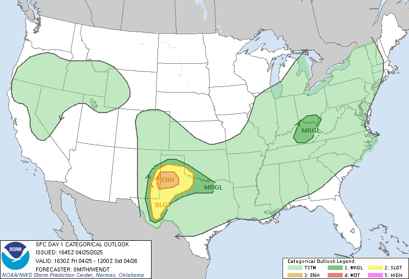
SPC Day 1 Convective Outlook