

Showing posts with label severe weather. Show all posts
Showing posts with label severe weather. Show all posts
Thursday, July 5, 2012
All Of East TN Under A Severe Thunderstorms Watch....
We have been tracking a System all day that is making it's way south in East Tennessee. For more information and the latest watches and warnings please follow us on Twitter and Facebook.


Sunday, July 1, 2012
Still Storms Lingering Across The Area....
There are still some storms lingering across the area with a severe thunderstorm warning in SW Sevier and SE Blount.
 |
| GRLevel 2 Base Reflectivity 10:36 PM EDT |
Storms Across The Area....
There are a couple of storms that have developed across the area. One has prompted a severe thunderstorm warning across parts of Morgan, Anderson, and Roane County.
 |
| GRLevel 2 Base Reflectivity at 6:05 PM EDT |
Wednesday, June 13, 2012
Change is in the air
Just wanted to say that I have the time to begin
blogging again and plan to update the blog on a more regular basis with weather
information for Eastern Tennessee. I
hope you find my blog useful and look forward to feedback.
Forecast Discussion:
It does look like the areas weather pattern will
switch from the rain we encountered early this week to a more tranquil pattern. The area will be under surface high pressure
along with translated upper level ridge.
Temperatures across the area will stay in the mid to upper 80s and lows
in the lower to mid 60s. We could experience
orographic based isolated thunderstorms as is typical across the area during
the summer months. The more interesting
weather will be in the far northern plain states where a strengthening upper
level low will move through the area resulting in the potential for severe
weather.
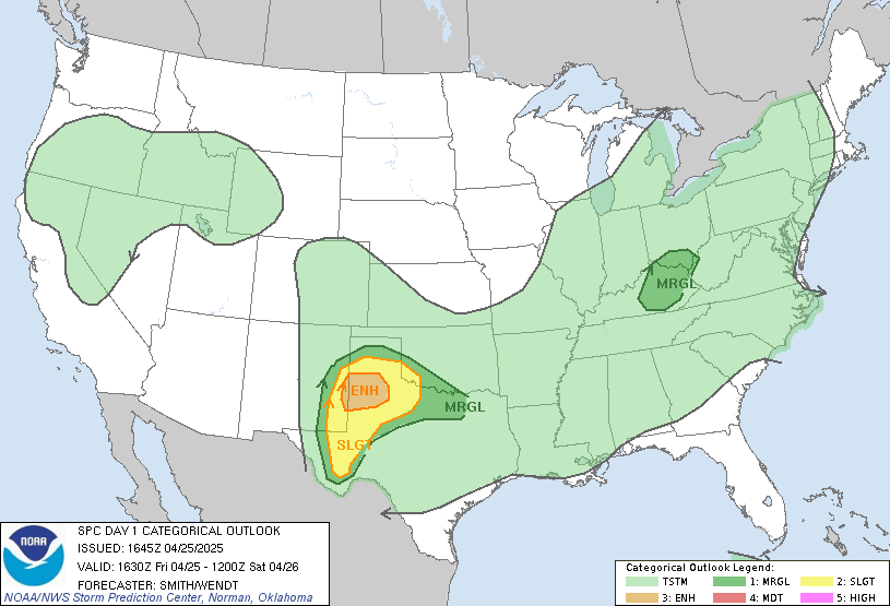
SPC Day 1 Convective Outlook
Subscribe to:
Posts (Atom)