Friday, June 15, 2012

Summertime Pattern in Place


Forecast Discussion:

It does look like this typical summertime persistence forecast will prevail across East Tennessee with highs in the mid to upper 80s and lows lower to mid 60s.  As for today 
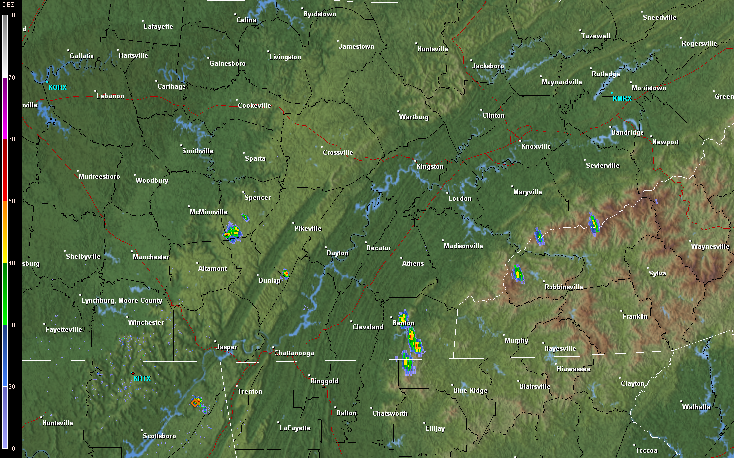
there are already showers and thunderstorms firing up across the Northern Plateau and will generally move to the east at 10 mph.  The pattern of storms will continue today with most of these storms firing up across the higher terrain.  Expect heavy rain and deadly lightning to be the main threat with these storms.

GRLevel 2 Radar Base Reflectivity 1518Z (11:18 AM EDT)

The long range model (GFS) does hint at a change in the pattern for later half of next week with an upper level trough swinging through the region.  This will aid in breaking down the 588 upper level ridge that is established across the Southeast.  I will continue to watch this as forecast models can and do change as we get closer to the forecast period.

NCEP 500MB map 06Z Valid for Saturday at 06Z (12 AM EST)

Thursday, June 14, 2012

Severe thunderstorm warning

Severe thunderstorm warning continues for Sevier, Blount, and Knox Counties


Storm Coverage Diminishing

The storms across the area continue to diminish in coverage as the afternoon goes on.  These isolated storms continue to plague the southern valley and higher terrain counties.  Tonight will be a nice night for most as storms continue to die with lows in the mid to upper 60s.

Severe Thunderstorm Warning issued for southern Blount County and Monroe County, TN


Severe Thunderstorm Warning has been issued for Southern Blount County and Monroe County, TN until 4PM

GRLevel3 Base Reflectivity 1952Z (3:52 PM EDT)

Showers and Thunderstorms Continue to Develop Across East Tennessee

Showers and Thunderstorms continue to develop across East Tennessee mainly across the higher elevations and southern valley.  The heaviest storms are located in Lake City, TN and Norris, TN and also down near Madisonville, TN and Sweetwater, TN.  Keep a eye to the skies as these storm will produce heavy rain and deadly lightning.

GRLevel 2 Radar Base Reflectivity 1906Z (3:06 PM EDT)

Showers and Thunderstorms Beginning to Fire in the Southern Valley

Showers and thunderstorms have started to fire over the southern valley with heaviest storm located in Polk County around Benton, TN.  Keep a eye to the skies as these thunderstorms could produce deadly lightning and heavy rains.

GRLevel2 Base Reflectivity KHTX 1615Z (12:15 EDT)

Isolated Storms

Forecast Discussion:


It does look like the typical summer pattern has set in with mostly sunny conditions expected with highs in the mid to upper 80s and lows in the lower to mid 60s.  Also you cannot rule out the chances of a isolated showers and thunderstorms this afternoon. The best chances will be across the southern valley where the better moisture and instability will exist.  Also monitoring a disturbance producing showers and thunderstorms over northeast Georgia and northern South Carolina which could increase chances of showers and thunderstorms.  I will be monitoring the new model data coming out this morning and update the forecast if needed.


SPC Mesoanalysis Data 11Z 06142012

Wednesday, June 13, 2012

Change is in the air


Just wanted to say that I have the time to begin blogging again and plan to update the blog on a more regular basis with weather information for Eastern Tennessee.  I hope you find my blog useful and look forward to feedback.

Forecast Discussion:

It does look like the areas weather pattern will switch from the rain we encountered early this week to a more tranquil pattern.  The area will be under surface high pressure along with translated upper level ridge.  Temperatures across the area will stay in the mid to upper 80s and lows in the lower to mid 60s.  We could experience orographic based isolated thunderstorms as is typical across the area during the summer months.  The more interesting weather will be in the far northern plain states where a strengthening upper level low will move through the area resulting in the potential for severe weather.

SPC Day 1 Convective Outlook